Toronto weather: Winter storm warning and sub-zero temperatures
Introduction: Why Toronto weather matters now
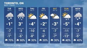
Toronto weather is in the spotlight as a winter system brings sub-zero temperatures and snow to the region. Cold snaps and winter storms affect travel, public safety and daily routines across the city; timely, accurate information helps residents and travellers make informed decisions.
Main body
Current conditions (local time 2026-01-26 02:41)
At 02:41 local time in Toronto (America/Toronto), observations show light snow with an air temperature of −12.8°C and a reported “feels like” temperature of −21.0°C. Wind is from the north at 11.4 mph (18.4 kph) with gusts to 15.8 mph (25.5 kph). The measured windchill is −23.1°C. Humidity is 78%, cloud cover is 100% and visibility is about 13 km. Small precipitation totals (0.12 mm) were recorded at the last update.
Snowfall, recent reports and forecast
Local reports and short-term forecasts indicate accumulating snow across late January. Weather25.com records recent daily totals including 9.1 cm on Sunday 25 January and 0.9 cm on Monday 26 January, with lighter amounts on other nearby dates. A Winter Storm Warning has been issued for 26 January 2026, warning of heavy snowfall and gusty winds that could disrupt travel and outdoor plans. The warning underscores the potential for difficult road conditions and reduced visibility during peak snowfall.
Typical winter context
Monthly summaries for the season show January averages in Toronto around a daytime high of −2°C and a low near −7°C, with January precipitation totals noted at roughly 54 mm in the Weather25.com overview. These figures underline that the current event sits within a typically cold and snowy period for the city, though the storm warning signals a period of heightened impact.
Conclusion: What residents should expect
In summary, Toronto weather on 26 January 2026 features light snow, strong cold and hazardous windchill down to around −23°C, with a Winter Storm Warning for heavier snowfall and gusty winds. Residents and travellers should expect possible travel disruption, colder-than-normal conditions and limited visibility. Monitor local forecasts and advisories, allow extra travel time and follow guidance from municipal and emergency services while the storm passes.