How a Weather Radar Map Keeps You Informed
Introduction: Why a weather radar map matters
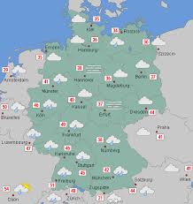
Weather radar maps are central to short‑term forecasting and public safety. They show live information about precipitation, storm structure and movement, helping forecasters, emergency responders and the public make timely decisions. In regions prone to heavy rain, snow or convective storms, radar maps are one of the fastest ways to see where hazardous weather is forming and where it is headed.
Main body: How radar maps work and what they show
Basic principles
Weather radars emit radio waves and measure the energy reflected back from raindrops, snowflakes and other particulates. Reflectivity is commonly reported in units called dBZ (decibels of reflectivity) and is displayed as coloured echoes on a map. Higher dBZ values generally indicate heavier precipitation.
Doppler and motion detection
Many modern radars use Doppler techniques to estimate the motion of precipitation relative to the radar site. This helps meteorologists detect winds within storms, rotation that can indicate tornadoes, and inflow or outflow boundaries that influence storm development.
Interpreting colours, echoes and loops
Maps use a colour scale to distinguish light rain, moderate rain, heavy rain, hail and intense echoes. Animated radar loops show movement and development: forward motion indicates direction, while intensifying echoes suggest strengthening. Users should also check product legends and time stamps so they know when the information was last updated—radar updates commonly occur every few minutes.
Limitations to bear in mind
Radar coverage is not uniform. The radar beam rises with distance, so low‑level precipitation may be missed far from the site (beam overshoot). Ground clutter, blockage by terrain and anomalous propagation can produce misleading echoes. Combining radar with surface observations, satellite imagery and local warnings gives a fuller picture.
Conclusion: Practical significance for readers
A weather radar map is a practical, near‑real‑time tool for assessing active weather. For everyday users it helps plan travel, outdoor activities and respond quickly to warnings. For professionals it supports nowcasting and emergency response. Knowing how to read basic reflectivity, motion and update times improves situational awareness and helps people make safer choices when weather becomes hazardous.